Friday, May 14, 2010

Public Access to Nutten Hook Shoreline Threatened

The Ferry Road crossing

Residents of Ferry Road in Nutten Hook are outraged by New York State's plan to close the Ferry Road Amtrak crossing and demolish five homes, including two on the National Historic Register. The closing will also block public access to one of the most unspoiled sections of shoreline on the Hudson River.


On May 13, 2010, the Hudson, NY  Register-Star reported:

Residents of Ferry Road heard directly from the state agencies that control their fate on Thursday morning. As in the past, they came away with more questions than answers. While holding court in Stuyvesant Town Hall, Administrative Law Judge Peter Loomis of the state Department of Transportation swore in three witnesses from his agency, along with one official from the Department of Environmental Conservation (DEC). Other officials and interested parties were also allowed to enter unsworn statements into his record.


The hearing re-opened a 1996 legal decision which declared the gated rail crossing at Ferry Road unsafe, and ordered it closed. An updated ruling in 2006 added that the crossing would remain open until a connector road was built to Ice House Road, a short distance to the north. Without a connector, three occupied homes on Ferry Road would be unreachable by emergency vehicles, and subject to purchase under eminent domain by the state.

This beautiful section of the Hudson River, once the scene of thriving industries, has long been of interest to us, and previous postings at Upstate Earth have focused on the ruins of the R&W Scott Icehouse and the Cary Brickyard . In the late 19th and early 20th century barges carried bricks and ice south to New York City, while a ferry plied back and forth to Coxsackie on the opposite shore.


Originally called Nutten Hoek, or "nut-tree point,"  by the 17th century Dutch, the bedrock promontory now known as Newton Hook may contain undiscovered artifacts of the Paleo-Indians whose presence has been documented at Tivoli Bay and other spots along this part of the Hudson estuary. The entire point is an undeveloped Department of Environmental Conservation site and included within the Hudson River National Estuarine Research Reserve.


As soon as we read of the state's sudden rush to close off the area, we went down to the river to take a look for ourselves. Our first stop was at Icehouse Road, where another open rail crossing will, according to the state, be improved with new safety features. From here we saw the wetlands across which a road was promised in 1996. Now, however, the state's Department of Environmental Conservation has changed its position. The wetlands, according to DEC's Betsy Blair, contain federally and state protected wetlands and any road, even a single lane along the dry land at the base of the Nutten Hook peak, is no longer acceptable.


View  from IceHouse Rd. of  Nutten Hook and wetlands

We walked south on 9-J for half a mile to the Ferry Road crossing, where an Amtrak passenger train was racing by. Crossing the tracks, we soon encountered a local resident who provided us with many details about the current struggle. Among the most interesting was that buying and destroying the houses on Ferry Road would cost more than $900,000 while building a half-mile long single lane road connecting Icehouse and Ferry Roads would cost, at most, a third as much.


Amtrak train at Ferry Road crossing


Activists' signs on Ferry Road


Now a private residence, the 1881 Lynch Hotel
is on the National Historic Register

We moved on to the point to enjoy once more this shoreline so popular with local fishermen, hikers, and picnickers. This is just about the only spot in the county where people can find easy access to the Hudson, which is almost everywhere else blocked by the railroad line. The boat access at nearby Stockport Creek has no access to the shoreline  and  high speed trains make it unsafe for children. And the one state park in the area which offers river access, Schodack Island State Park, is set to be closed on May 16 due to the state's budget shortfall.


View of Coxsackie waterfront from site of the old ferryboat pier


Ocean-going freighter bound for the Port of Albany


Hudson River beach at Ferry Point

Still puzzling over why state agencies would join forces to close off this shoreline, we followed the trail leading from Ferry Rd to Ice House Rd.  This level route along the eastern edge of Nutten Hook hill is on dry ground and it seems clear that a single lane road could be constructed on this route at minimal expense and without any significant damage to the wetlands.


This trail between Ferry and Icehouse Roads could be 
converted to a single lane road

View of Catskill Mountains from the peak of Newton Hook


Ruins of the R& W Scott Icehouse, built in 1885


What can be done to preserve access to Nutten Hook?


The residents of Ferry Road have created a website, Save Ferry Road, which explains the whole situation in detail and provides a list of officials in the state Department of Transportation and the state Department of Environmental Conservation who have joined forces to destroy this small community and block public access to the river.

The site also provides contact numbers for  the local representatives for Senator Kirsten Gillibrand and Congressman Scott Murphy, both of whom have written letters of support for saving Ferry Road. 


I am in the process of contacting these people and will post updates as to their response. I urge you to do the same.

Update June 10, 2010

DEC's Gene Kelly has written back saying that "the development of a connector road from Ice House Road to Ferry Road across the Reserve would impact the sensitive wetlands, archeological artifacts, and important wildlife habitat found at this site," without mentioning any post-1996 study substantiating the claims. He adds that: "assuming the state's fiscal climate improves, the Department anticipates building  a parking area and handicapped accessible trail to the Hudson River at the end of Ice House Road."

Congressman Murphy's assistant Rob Scholz said that the Nutten Hook issue was one for state representatives. None of the other officials whom I contacted have responded.

Update May 29, 2011 Newton Hook Rail Crossing Gets a Reprieve

The Albany Times Union carried a report today that "a  DOT administrative law judge ordered that the crossing remain open and be improved with federal stimulus funding while DOT studies long-term safety improvements. DOT has to file its report by June 30, 2012."


Report from Schodack Island State Park


Schodack Island State Park is one of 91 state parks and historic sites being closed May 16 as part of Governor Patterson's budget cuts, thus cutting off one more public access to the Hudson in our area. Fred Lebrun has excellent analysis of the politics behind this decision in  Padlocked Parks Lock Out Sense in the Albany Times Union.

The park already shows signs of neglect as the shutdown process gets underway. I biked along the extensive trail system, surprised to see no other bikers or hikers. Then I realized why. The trails are blocked in many places by fallen trees that would ordinarily be quickly  removed by park employees.

 Trails are blocked by fallen trees


 Idled State Park Police boats

The park was once three islands, before being combined into one by dredging, and is believed to be the place where Henry Hudson was welcomed by the Mohican people. Archeologists have done little work at this site, but it is known that the aboriginal people maintained corn fields in the rich alluvial soil of the island. Artifacts from this forgotten culture have been dated back to 5000 years ago, and there is doubtless much that we could have learned from them about living in harmony with the natural world.

Replica of Henry Hudson's Half Moon at Albany


Although they welcomed Hudson and his crew with a friendliness that was in sharp contrast to the more warlike peoples encountered near the river's mouth, their fate was not a happy one. Decimated by European diseases, the Mohicans lost several wars to the Mohawks, who adopted firearms and dominated the violent struggle for the furs in such demand by the European market.


 The 18th century Mohican Chief  Etow made
his home on this island or the nearby shore.


Update on Schodack Island

Schodack Island State Park was briefly closed, along with many other state parks, and then reopened to the public after additional funds were voted in Albany.

Update on Newton Hook

After many years of attempting to close the Ferry Road Crossing, State Department of Transportation finally gave up in september, 2012.

Monday, May 3, 2010

The Burning of Schenectady, 1690


On the bitter cold night of February 8, 1690 the village of Schenectady lay deep in sleep. As the snow and wind increased, a band of 210 French soldiers and their Indian allies studied the sleeping town from across the frozen Mohawk River. Although surrounded by a stockade of logs ten feet high, the town’s two gates stood wide open and unguarded.There were no lights nor signs of movement in the small fort located on the northern side of the palisaded town.

The Mohawk River, from Riverside Park: probable site of French crossing

Three weeks earlier, the French commander Lemoine de Sainte Helene had led this small band out of Montreal, trekking on snowshoes through the deep snow of the Adirondacks for twenty-two days to reach the frontiers of the English colony.

The soundly sleeping settlers were mostly Dutch, and some of the eldest among them recalled the founding of their village four decades earlier by the redoubtable Arendt van Corlaer (or Curler), the Great Friend of the Mohawks. The Mohawks held Corlaer in such high regard that they ever afterward referred to the chief white man, whether Dutch or English,  as The Corlaer, and transferred to him their lasting loyalty.

The French who now lingered outside the helpless village had come south as much to crush the powerful Mohawks as to destroy Schenectady and its larger neighbor, known since 1664 as Albany. The war which now came with such stealth to the Mohawk Valley had its origins far across the Atlantic. When James II, a Catholic and friend of France, was forced to give up his throne in1688 in favor of the protestant William of Orange, worldwide war between England and France became inevitable. William and his wife Mary Stuart, backed by a lively parliament, were more than ready to duel with France for control of vast stretches of the New World. Even so, the villagers knew little of the quarrels of distant monarchs , and in the dead of winter, had no fear of any attack.

Louis XIV of France was ultimately 
responsible for the massacre


 William and Mary, whose ouster of James II
in 1688, led to war with France

The site of massacre is still  known as "The Stockade," and is a very desirable residential neighborhood of historic residences cherished by its inhabitants.


Elegant 19th century ironwork is common 
on houses in the Stockade neighborhood

According to Jonathan Pearson’s 1883 history of Schenectady:

The village at this time lay mainly west of Ferry street, and was stockaded with palisades of pine logs ten feet high. It had at least two gates, one at north end of Church street, opening out to the highway (Front street), which led to the eastward to Niskayuna. Another at south end of Church at State, opening out to Mill lane and the Flats and the Albany road (State street).The only dwellings outside the stockade were built on the northerly side of State street, extending as far south-east as Centre Street. It is said there were 80 good houses in the village and a population of 400 souls, both numbers doubtless greatly exaggerated.

House on Ferry Street, along which the palisade ran in 1690

In the northerly angle of the village on or near the corner of Washington and Front Streets was a double stockaded fort garrisoned by a detachment of 24 men of Capt. Jonathan Bull's Connecticut company under the command of Lieut. Talmadge.

No trace remains of the 1690 era settlement, except perhaps in traces buried beneath the streets and houses of this attractive neighborhood, although the Brouwer house may date back to the time of the massacre or just a little later.

 The oldest house in Schenectady

Originally planning to wait until much later at night to attack, the French and Indians were driven by the unbearable cold to strike at once, entering the village without hindrance and assembling in small groups outside each house. Then, according to Professor Pearson, the slaughter began:


In the ill fated village, the inhabitants went to rest with their gates open and no guard set. They trusted that the Indians who had been sent out as scouts to Lake George would forewarn them of the enemy's approach. The French marched upon the village from the north, crossed the river on the ice and divided their men into two companies with the intention of entering the town, one by the north or Church street gate, the other by the south or State street gate. The latter entrance being in a measure covered by the dwellings on that street could not be found; both companies therefore entered by the north gate and separating, spread themselves throughout the village, five or six before each house. At the signal agreed upon, a simultaneous onslaught was made upon each dwelling and before the terror stricken inhabitants could seize their arms, the savages were upon them. Resistance was vain. Within two hours 60 of the people were slaughtered without distinction of age or sex. After selecting such booty as they could carry away,the French fired the houses and burnt all but five or six.

1898 plaque commemorating the massacre of 1690

 A tourist reading the 1898 plaque

This was a slaughter. The only successful resistance was offered by Adam Vrooman and his family at their house, which stood on the west corner of Front and Church streets opposite the north gate. Evidently, they maintained a steady fire which kept the enemy far enough back so that they could not set fire to the house.

Professor Pearson speaks of one other family that escaped destruction:

Capt. Sander Glen's family and relatives with their habitations and other property, on account of former kindness shown to captive Frenchmen, were spared by express order of Lemoine de Sainte Helene

The Glen Sanders Mansion

Portions of the elegant Glen Sanders Mansion, now a popular wedding and banquet venue, may date back to Captain Glen’s house spared in 1690.

By the  morning of February 9, 1690, the French and Indians headed back into the northern forests with  27 (or 30) prisoners and 50 horses laden with plunder, giving up on the original plan of destroying Albany and burning the Mohawk villages farther west along the river.  African slavery was widespread among the Dutch and slaves were among those killed and taken prisoner.


 Historic marker recognizing the role of Symon Schermerhoorn

Symon Schermerhoorn, though wounded, had managed to escape the slaughter that night and raised the alarm. According to records preserved in Albany, the call to arms was given but the militia decided not to pursue the enemy lest they leave Albany undefended.

The official French report by M. de Monsignat, quoted by Professor Pearson, reveals that the French lost 17 and the Indians four on the return journey. The names of all those carried off as prisoners are included in primary sources included by professor Pearson in his chapter on the massacre. Many of those taken were ransomed and returned to the Mohawk Valley in succeeding years.

The enemy was pursued, although apparently only by the Mohawk friends of the settlers, who caught up with the French just before they reached Montreal and killed six. Their actions were commemorated by the erection of a statue in 1887 of one their number, known as "Lawrence the Indian." The statue was placed at the junction of Front, Green and North Ferry Streets, which marks the northeastern extremity of the stockade and blockhouse.            


Lawrence the Indian statue

The war ended inconclusively, but was renewed again in 1725 and 1755 before the French were finally defeated. Schenectady was never again directly attacked, although much blood was shed nearby in the series of wars that originated in European rivalries.

Update on location of the 1690 Stockade

I recently heard from Tom Morgan, an avid researcher of local history and a follower of this blog.  Tom generously provided an old engraving  which he believes to be a fairly accurate depiction of the village at the time of he massacre.


Tom also provided the information below and his own chronological map showing the location of the three stockades which stood on this site.


At the time of the massacre the village lay mainly west of Ferry Street, protected by pine palisades ten feet high. The only dwellings outside the palisade were on the north side of what is now State Street. Near the corner of Washington and Front stood the double stockade fort which fell so easily on the fatal night. After 1690 the palisade was rebuilt, and was again rebuilt in 1705 to include more of the expanding village.  Being made of wood, the walls and fort had a limited lifespan and needed to be rebuilt once more in 1735. This time the fort was constructed with timbers on a stone foundation.

The fort remained an essential feature of each rebuilding. When the village was restored  just after the massacre, a new and larger fort was constructed in the southwest corner of the enclosure, the original fort being used as a blockhouse and church. This fort contained "two great guns." In the 1705 renovation, a fort was built in the northeast corner, variously called Corlear's Fort, Fort Cosby and the Queen's Fort. In the 1705 and 1735 reconstructions, the "Queen's New Fort" was built at the east angle of the stockade. The fort remained  standing through the Revolution and was finally torn down in 1783.

The expense and effort which went into the fortification of this site is testimony to the uncertain and violent century which followed the 1690 attack. Although wars swirled around Schenectady, however, it was never again attacked.

The neighborhood thrived in the peaceful and prosperous era that accompanied independence but was in decline by the mid 20th century. Tom informed me of the formation of the Stockade Association in 1958, through whose efforts the area was designated as the first Historic District in the state, saving many buildings from destruction and preparing the way for the attractive residential neighborhood it is is today.


Saturday, April 17, 2010

The Utica Insane Asylum

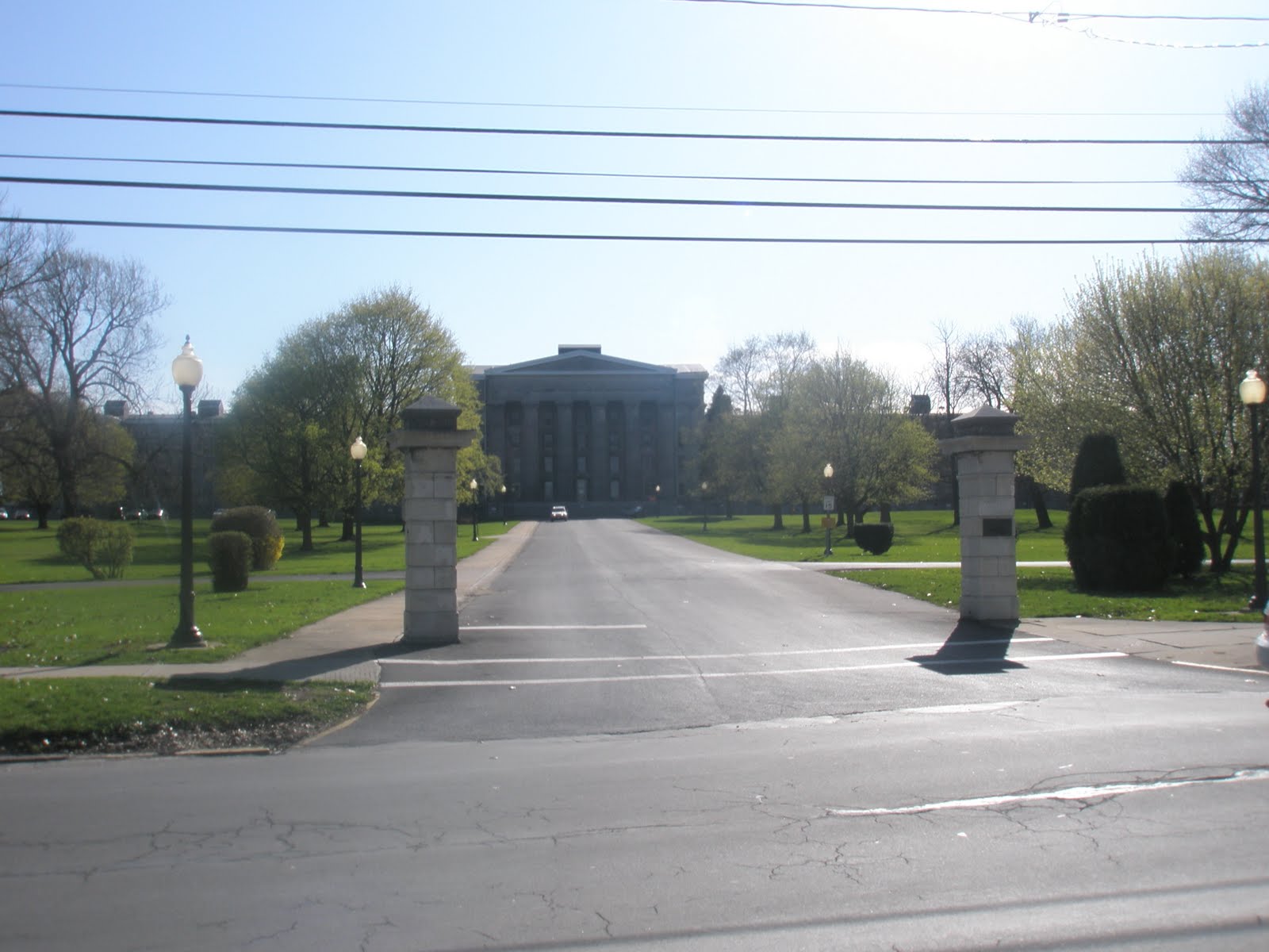
In the heart of Utica stands an enormous Greek Revival edifice rivaling in size and grandeur the palaces of European royalty. Opened in 1843, the building is 550 feet long with a central portico of 120 feet, dominated by six limestone columns 48 feet high and eight feet in diameter.


In keeping with the values of the young American republic, this grand structure was built not for a privileged aristocracy, but for the care and treatment of the most forlorn and neglected of our citizens. When it was opened, the New York State Lunatic Asylum in Utica was the first such institution in the state and one of the first in the nation, part of a nationwide response to the call of reformer Dorothea Dix for humane treatment of the mentally ill, who were previously housed in jails or in private homes. Thomas Kirkbride, an early psychiatrist, echoed Dix’s concern by calling for huge institutions across the nation that could provide "a special apparatus for the care of lunacy, whose grounds should be highly improved and tastefully ornamented."


The first director of the Utica Asylum was Dr. Amariah Brigham, who believed that useful agricultural and other manual work could provide excellent therapy for the hundreds of patients who were soon sent to Utica from all parts of the state.  The outbuildings that once contained therapeutic workshops still stand, in good repair, on the asylum grounds, and some are in use by various state agencies. According to Marc Harf, writing in 1981 for an exhibit at the Munson Williams Proctor Institute: “The prevailing medical theory of the 1830's advocated that patients be segregated by sex and type and degree of illness, with each group housed in a self contained unit. As far as possible, the interior layout of the building was arranged to provide optimum conditions for the patients.”


Dr. Amariah Brigham

Mr. Harf  described the vast scope of the asylum: “In 1850, a listing of accommodations noted: 380 single rooms for patients, 24 for their attendants, 20 dormitories each accommodating from 5 to 12 persons, 16 parlors or day rooms, 12 dining rooms, 24 bathing rooms, 24 closets and 24 water closets. The mechanical systems of the original building incorporated the latest improvements. Hot air woodburning furnaces in the basement provided heat for the building. Ventilators opening from the rooms to flues in the walls allowed air to circulate constantly. Hot and cold running water was supplied to each floor, the cold water coming from the roof while the warm water was pumped by a steam engine from basement storage tanks.”

19th century outbuilding now housing an addiction services center


Dr. John Gray, another leading psychiatrist of the era, took over as director in 1854.   Gray’s national reputation was such that he was called in to ascertain the sanity of Charles Guiteau, the assassin of President James Garfield in 1881. (Guiteau was ruled sane and subsequently executed.) In contrast to Brigham’s belief in “moral” causes of insanity, Gray believed that mental illness was rooted in brain functions.


Dr. John Gray


Under Dr. Gray, however, the great optimism regarding such institutions began to dissipate.  Long before the insights of Freud and other pioneers, and without the medications provided by modern pharmacology, the kind of treatments pioneered by Dr. Brigham did not produce the envisioned improvements.

The definition of mental health was also, of course, conditioned by 19th century mores. Same sex orientation or any form of sexual expression, particularly by women, beyond traditional monogamy could, and did, lead to a diagnosis of insanity. Even non-traditional religious beliefs, such as those of the "Millerites," whose beliefs in an imminent Second Coming have since become a part of the American mainstream,  could be grounds for committal.

Frustrated by attempts to “cure” mental patients, other and harsher methods were tried. The “Utica Crib,” a device meant to confine patients who might harm themselves or others, may have been well-intentioned but was soon criticized widely as the equivalent to putting human beings in cages. Abuses of patients occurred, including the murder of one by an employee, and were the subject of widely publicized hearings at the state legislature. And Dr. Gray himself was shot by a former patient in 1885 and never fully recovered.


The "Utica Crib," courtesy University of Iowa Medical Museum

Other abuses were uncovered in succeeding decades and the once bright hopes of reformers grew ever dimmer, until eventually huge buildings like the Utica Asylum came to be seen as obsolete and by 1978 the Utica asylum, known locally as “The Old Main,” was closed.

In 1989 the asylum was named a National Historic Landmark and in 2005 major renovations of part of the building  took place, and now house the Records Archive and Repository for  the New York State Office of Mental Health.


Director's house on the Asylum grounds, currently vacant

The asylum grounds on Court Street today present a peaceful picture, with little to remind the visitor of the immeasurable human misery of the past. A bunch of flowers placed on the front steps, however, suggests that one anonymous visitor, at least, remembers the thousands who were incarcerated here over a period of 135 years.


 Flowers left by an anonymous visitor


Dr. John Gray appears as a character in my novel based on a notorious murder that took place only a few miles from the Utica. Asylum.  Available for $19.95 at Wilderness Hill Books. and $2.99 on Kindle.

Saturday, April 10, 2010

Dewey Loeffel and The Toxic Legacy of General Electric


 Since 1878 the General Electric Company has been a vital part of the economy and culture of this region, and is proud of its history. From its earliest days under the guiding genius of Thomas Edison, GE was a pioneer in the development of electric light, radio and television, home appliances, jet engines.  For a century and more, upstate families have grown prosperous, thanks to GE, and many local retirees still count, with some anxiety in recent years, on GE's dividends.


However, there is another legacy of GE:  the toxic byproducts of  manufacturing that were were dumped throughout the Hudson and Mohawk watershed.  Many people are familiar with GE's decades-long resistance to cleaning up the toxic sludge dumped into the Hudson from its Fort Edward plant.   Less than a month ago, the Albany Times Union reported that GE and the EPA were still clashing over the depth and frequency of the dredging that will be necessary between Fort Edward and Troy.

According to the EPA, the quantity of toxic PCBs in the river is almost triple initial estimates because "hot spots" were much deeper than predicted, and were sometimes covered with logging debris from mills upriver. EPA wants to dredge more river bottom more deeply but less often, to capture more PCBs while causing less stirring up. GE has a different view, so the cleanup slows down while the conflicting views are referred to a panel of independent experts.


The Dewey Loeffel toxic dump lies in the beautiful countryside 
north east of Nassau, NY

The Hudson River, however, is not the only place where GE dumped polychlorinated biphenyls and other industrial waste such as paints, solvents, resins and oils. Beginning in 1952, GE arranged with a Rensselaer County landowner, Dewey Loeffel, to use 11 hilly acres of his property on Mead Road in the town of Nassau as a dump site and this arrangement continued until ended by the state in 1968. (To be accurate, GE wasn't the only contributor to this dump. Bendix Corp. and Schenectady Chemicals, both still in business, gave their share.)


 The Dewey Loeffel landfill, 42 years after it was closed


Forty-two years later, poisonous chemicals  from this site are still at high levels in  the waterways of Rensselaer County, while generations of GE-hired lawyers and experts  have  dragged their heels over every attempt to clean up the 46,000 tons of carcinogenic material.

According to the EPA, GE operators had, by 1974, covered and graded the drum disposal area, oil pit, and lagoon with soil, and constructed drainage channels to control runoff. In 1980, GE entered into an agreement with NYSDEC to perform additional investigation and remediation at the facility. 

For all this time, it seems apparent that the company lacked any sense of urgency. It was not until 1980, for example, that a series of tests by the New York State Department of Environmental Conservation even determined that the toxic waste was spreading into local waterways and aquifer despite the initial work done on the dump. This discovery resulted in GE removing 500 surface drums and four 30,000 gallon oil storage tanks, and installing a NYSDEC-approved slurry wall, clay cap, and leachate collection system during the years from 1982 to 1984.


Water is still seeping from the landfill

Twenty (Yes, twenty!) years later, in 2000 GE spokesperson Joan Gerhardt said that the company would begin to remove the contaminated spill "voluntarily and at its own expense in the spring." (of 2001) Miss Gerhardt observed that this voluntary step would be "a headstart on the cleanup" while the DEC continued to mull over the company's 1998 proposal for a larger cleanup. GE, at that time, was monitoring only 22 wells in the area, even though the water from the landfill flows across two counties on its way into the Hudson at Stockport.


 A tributary of Valatie Creek a mile southwest of the Dewey Loeffel Landfill

In 2000 it was determined that the sediment in Nassau Lake, which is formed by a dam on Valatie Creek, contains 2.3 ppm of PCBs and that fish in the lake had many times that level, although the water itself had no detectable PCBs. (SOURCE)

According to the EPA, this dam keeps PCB-laden 
sediment restricted to Lake Nassau


The fish in Nassau Lake still have dangerously high  PCB
levels 42 years after Dewey Loeffel was closed

Over the next two years, the NYS Department of Environmental Conservation held many meetings with local residents and produced two lengthy  Record of Decision documents in December 2001 and January 2002.
By 2004, GE had removed approximately 15,000 tons of PCB-contaminated soil and sediments from the site drainage-way between the facility and Nassau Lake.
A person might assume in 2004 that the Dewey Loeffel mess was finally being cleaned up, 36 years after it was closed.

Not so.

The flood of paper continued over the past six years and the Town of Nassau now has on its website thirteen more documents composed from the last two years alone. The audio of the March 4, 2010 meeting is well worth listening to, because it was at this meeting that the federal EPA joined the state DEC to provide one more disappointment to long-suffering local residents.

On the audio you will hear federal EPA official Mel Hauptman tell residents that "Everyone should understand that it is a slow process" and "This area is polluted enough it could be still on the list in a hundred years when we are all gone." Using GE-provided graphics, Mr. Hauptman  took those present on a tour of the toxic sites reaching from the landfill down Valatie Creek into Nassau Lake.   Hauptman said of  fish in the lake  that "there may be a downward trend but I'm not getting too excited" since the toxicity is still so high that neither humans nor wildlife could safely eat the fish.  He tried to be reassuring to the audience  about dangers to human life and health from contaminated groundwaters and wells.

Although there was little good news for those at the meeting in the VFW Hall on Lyons Lake Road, Hauptman said that the toxic chemicals were not (yet) spreading further downstream on the Valatie Creek: "The lake is acting like a trap to keep PCBs from proceeding downstream."

However, children and pregnant women are advised to eat no fish from Kinderhook Lake, so apparently some PCBs are drifting downstream. The virtual absence of fishlife in Valatie Creek below the Niverville Dam is puzzling and may be related.


Valatie Creek flows south from Lake Nassau

through North Chatham

into Kinderhook Lake


and then joins Kinderhook Creek in the village of Valatie

Despite Hauptman's assertion that the toxic chemicals are limited to the waterways north of the Nassau Lake dam, downstream residents need to get involved in the fight that the people of Nassau have been waging for so long. Finally, under the Obama administration, there are signs of life within the previously moribund EPA and the Dewey Loeffel site is under consideration for addition to the EPA Superfund. This will, if approved,
"allow the EPA to make the responsible parties clean up their contribution to contaminating the site."

We are currently in a 60-day comment period, which began March 3,  in which the public is encouraged to voice their opinions on giving the  Dewey Loeffel  landfill Superfund status.

For instructions on submitting comments, go to:


Cross published at All Voices